Map of India

Description
Map of India
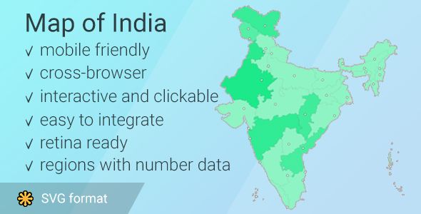
Interactive clickable and responsive map of India with states popup on hover. This map runs with javascript (jQuery) based on Scalable Vector Graphics (SVG), So it can be scaled to any size without losing its quality. The interactive template of the map of India gives you an easy way to install and customize a professional looking interactive map with 28 clickable states with their capitals (+8 union territories). You can embed the map in your website and link each state/city to any webpage or make hover popup with information. In this version of map you have possibility to put number to any state and it will change color depends of number (the most big number will make state saturated, the most little – dim)
Features:
1. The map consists of HTML/CSS/JS files.2. It works on different platforms without any additional plugins.
3. Editable popup over each state and city for. (you need only edit content of “data-title” attribute)
4. Responsivness. This map can fit in its available dimension without horizontal scroll
5. Runs with javascript, no flash required, support iPad and iPhone
6. Full documentation included
7. Easily customized through simple JavaScript/css files
List of the clickable states in the map of India
- Andhra Pradesh
- Arunachal Pradesh
- Assam
- Bihar
- Chhattisgarh
- Goa
- Gujarat
- Haryana
- Himachal Pradesh
- Jharkhand
- Karnataka
- Kerala
- Madhya Pradesh
- Maharashtra
- Manipur
- Meghalaya
- Mizoram
- Nagaland
- Odisha
- Punjab
- Rajasthan
- Sikkim
- Tamil Nadu
- Telangana
- Tripura
- Uttar Pradesh
- Uttarakhand
- West Bengal
- Andaman and Nicobar
- Chandigarh (only capital)
- Dadra and Nagar Haveli and Daman and Diu
- Jammu and Kashmir
- Ladakh
- Lakshadweep
- National Capital Territory of Delhi
- Puducherry
Each state can be customized independently (link, hover information, etc).
File Included :
1. folder with documentation (html wile with some images)2. an file index.html (svg with pathes)
3. an file with styles (India_map.css)
4. an file with logic for hover (India_map.js)
5. an external connection of jQuery
6. Included 28 states of India (+8 union territories) with thir capitals
- 6 month free support included from author
- Free lifetime product updates guarantee
- 360 degrees quality control
Related products
Our website uses cookies
We use cookies on our website. By continuing to use our site, you consent to the use of cookies as described in our Cookies Policy.


